FREE UK tracked delivery
 Order by 12pm Mon-Fri for same day dispatch
April 2021 - Route planning on the move
by Nigel Williams
In the Scottish Be Avalanche Awareness (BAA) advice it is reckoned that planning a winter route must take account of 3 main elements; the avalanche and weather forecasts, the terrain to be travelled over and the skills/fitness/equipment of the group. This process should be around 70% of the time given to planning.
Once on the journey, the second phase is to match the forecasts to what we see on the ground reality. This might be 25% of the overall time given to planning. At the initial planning stage we should have identified a couple of key decision points. If all the rest of the planning process has been in place then this accounts for the remaining 5% of planning time.
The same principles should apply to planning a summer route. Once on the move we usually know after the first hour or two if we have overestimated speed or ability of the group and start recalculating things. We assess the accuracy of the weather forecast and the state of the path etc. We should also have identified some key decision points, such as whether we can cross a river or not, or where there are shortcut options, missing out Great Close Hill for example on the Malham circuit, or even a turn back point.
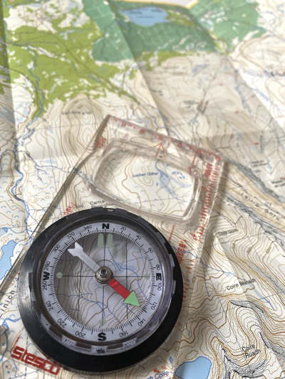
This might all sound a bit formulaic, but planning and studying the map in detail is for me one of the pleasures of hill walking, and looking out to see how well the map relates to the ground. It makes the navigation on the day more efficient and enables one to keep a realistic track of progress.
Using Naismith's formula we can check our progress throughout the day. Choose ideally a 1km section of the route and time how long it takes to walk it while we wander along chatting. 15 minutes is 4kph, 20 minutes is 3kph. Avoid doing this at the start of the day when people often start off at 5kph - 12 minutes per kilometre. The same task can be more accurately done with a GPS function on a phone of course.

Let's say the day was planned around 4kph - 1.5 mins per 100m. We have a flat 8km to cover and two hours to our due back time. Timing 100m with our casualty takes 2 mins = 3kph, we will be 40 mins overdue. At this point in the day we are better able to manage the problem. Maybe call someone to let them know we will be late, we may have an option for a short cut and a pick up etc. It takes the stress out of the situation for everyone concerned.
Return to the Navigation Blog