FREE UK tracked delivery
 Order by 12pm Mon-Fri for same day dispatch
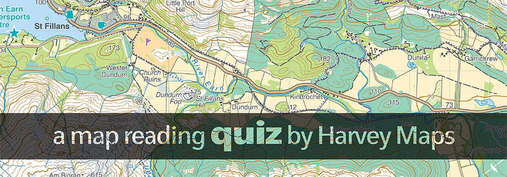
Map Reading Quiz
Think you know maps? Let's test your knowledge ...
DIFFICULTY RATING: DIFFICULT
If you are stuck at home right now and missing the great outdoors, try our map quiz and test your knowledge on map features, map reading and more. Good luck!
Answer sheet available as a PDF from the link below
- On a Harvey 1:40,000 scale map why are some contours shown as grey lines?
- On a Harvey 1:40,000 scale map why are some contours shown as dashed lines?
- What does the term "slope aspect" mean? (It is one of the most useful pieces of information if lost in the hills or navigating in winter).
- A two-part question: a) On an OS 1:50,000 scale map every solid black line is a man-made feature except for one, what is it? b) Is this the same on a Harvey 1:40,000 and an OS 1:25,000 scale map?
- On a Harvey 1:40,000 map and an OS 1:25,000 map there are often white strips marked in wooded areas, what do these indicate?
- What is the manufacturer's estimated tolerance (level of inaccuracy) on a standard base plate type of compass used by most walkers? (Clue: it is currently more than magnetic variation in the UK)
- If travelling to an objective on a bearing for 1000m what lateral distance could you be from the objective with a 2.5 degree error?
- The military use "mils" instead of degrees for greater accuracy. How many mils in a circle? (The angle of 1 mil measures a distance of 1m at 1km from the observer)
- What is the standard datum setting for a GPS in the UK?
- What size of an area does a 6-figure grid reference refer to?
- What is the maximum distance two people could be apart for the same 6-figure grid reference?
- Why do orienteering maps use white instead of a shade of green for open runnable forest?
Answers and Resources
You can download a PDF version of the Map Reading Quiz and the Answers.