FREE UK tracked delivery
 Order by 12pm Mon-Fri for same day dispatch
Tackling the Coast to Coast National Trail
by Nigel Williams
A-to-B journeys require commitment and resilience. There's an underlying pressure to maintain your itinerary; giving up can feel like failure, compounded by practical concerns such as lost accommodation bookings and additional travel costs.
There are interesting parallels between long-distance walking and expedition travel. High-altitude mountaineering, for example, involves a high level of objective danger, but also allows for planned rest days and, in many cases, the option to retreat to base camp. In contrast, A-to-B polar expeditions tend to involve lower objective danger but demand relentless forward progress. Everything is carefully calculated to minimise weight, and travellers must keep moving day after day to avoid running out of food or fuel. Rest days only come when weather makes travel impossible - and anyone who has spent time tent-bound in bad conditions knows that these are far from restful.
An A-to-B journey across any country feels like a significant undertaking. You can look at a map afterwards and truly appreciate the scale of what you've achieved. There's also the simple reality of time: committing two to three consecutive weeks to a recreational pursuit is rare these days, requiring time away from work, family, and everyday responsibilities.
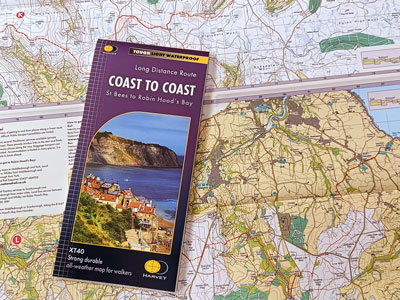
The real challenge would be to do it without your phone, or at least without switching it on. The route is well signposted and HARVEY map has the whole route laid out on a single sheet with plenty of navigational and general information along the way. You don't need half a dozen traditional maps most of which are irrelevant except for the route itself. I hate carrying anything that is not useful and that includes large volumes of paper.
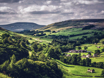
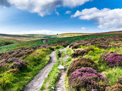
Walking west to east, from St Bees Head on the Irish Sea to Robin Hood's Bay on the North Sea, is the most popular direction. You're more likely to meet others following a similar itinerary, which can add a social element to the experience. It's also often considered the more practical option: prevailing winds are usually behind you, rainfall tends to decrease as you move away from the Lake District, and the terrain gradually becomes gentler - welcome relief for tired legs.
Walking east to west is less common but equally valid. Using a standard guidebook requires reading it in reverse, but there are advantages. The early stages allow you to build fitness before reaching the more demanding terrain of the Lake District, and arguably the best views of the journey are saved until the end.
Some people choose to complete the route in stages over a number of years. This spreads both the cost and the time commitment. Alternatively, there are many companies offering support options, ranging from fully guided experiences with accommodation and meals arranged, to simple luggage transfer services that allow you to walk with just a day pack and enjoy clean clothes each evening.
Navigation is straightforward now that the route is an official National Trail. With a HARVEY map, you can track your progress by ticking off landmarks along the way. If in doubt, the simplest approach is to retrace your steps to the last known point. Even more simply, the sun can serve as a basic guide: walking west to east, it rises ahead of you, sets behind, and sits to your right during the day. Reverse all of that if travelling east to west.
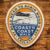
Why not celebrate your achievement with a Coast to Coast Adventure Patch - perfect for the outside of your rucksack!
Return to the Navigation Blog