Product Description
Covers a large area yet is handily compact. Pocket perfect!
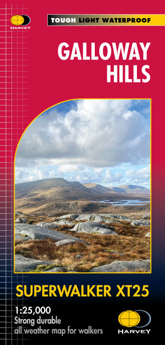
Detailed map for runners and walkers of the Galloway Hills which form part of the Southern Uplands of Scotland. This map covers Glen Trool and Loch Dee north to Loch Doon and Carrick Forest. It covers a large part of the popular Galloway Forest Park.
The Minnigaff Hills, Merrick, Corserine, the Dungeon Hills and many lochs make this area a delight to walk.
1:40,000 scale.
Includes 3 Corbetts, 4 Grahams and 11 Donalds.
Click here to view map coverage
Fully detailed genuine HARVEY mapping
Use without a map case: tough and 100% waterproof
Opens directly to either side of the sheet
For more information on the Ultramap click here
Mountains on this map
| Mountain | Class | Height | Grid Ref |
|---|
 FREE UK tracked delivery
 Order by 12pm Mon-Fri for same day dispatch