FREE UK tracked delivery
 Order by 12pm Mon-Fri for same day dispatch
Meet Nigel Williams - a Q&A
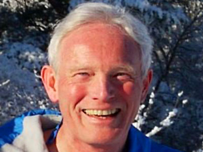
In our latest Q&A, we find out more about Nigel's life in the outdoors industry, what's on his bucket list, and most importantly, his favourite HARVEY Map!
Can you tell us about yourself and your professional life?
Like many young people, it started at school with the Duke of Edinburgh (DofE) award and a little rock climbing and kayaking. After school I spent 16 years in the Army, 9 of which were spent working at Mountain Training Centres across the UK and Norway, as well as multiple Himalayan climbing expeditions. I left in 1993 with a long list of qualifications in orienteering, Nordic skiing and civilian mountaineering, then began working at Fife Council's Ardroy Outdoor Education Centre.
I went from teaching soldiers winter climbing on Ben Nevis, to gorge walking, small mammal trapping and canoeing with primary children. After a couple of years, I went on to be the Outdoor Education Co-ordinator for the Council, based in Glenrothes, behind a desk! In 1997 I applied for the Chief Instructor role at Glenmore Lodge and much to my astonishment got the job and a chance to be back out in the mountains.
I'm semi-retired so can pick and choose work, but I keep it varied by working with a wide range of organisations - from kids doing their DofE, to Polar and expedition skills with doctors and medics. I have at least a month in Norway each winter teaching Nordic skiing, and a Greenland winter expedition with the Polar Academy. I am a director of the National Navigation Awards Scheme (NNAS) and also a member of a Royal Institute of Navigation (RIN) Outdoor Adventure Navigation working group, and of course working for HARVEY Maps!
In between all that I have been leading a community project with Sustrans to get a cycle path between our village and Grantown on Spey, which the local authority had intended to do in 1995. After 4 years we have finally reached the formal planning application stage!
You have been head guide for the Polar Academy charity since 2014, and Trustee since 2020. What is the Polar Academy?
The Polar Academy is a Scottish charity set up in 2013 that works with invisible teenagers who are often struggling through school as well as challenging experiences at home. Virtually all of them have experienced bullying which has crushed their confidence, resilience and self-belief. There is a selection process and a year-long training programme, culminating in a 10 day skiing expedition, which includes pulling sledges and camping in Greenland. We take 10 children and a teacher from two schools. Those that don't quite make the winter team can take part in other activities and do a summer exchange programme with Inuit children.
There is a strong educational theme in the programme as well. On their return, they will give talks around other schools, businesses and charity groups to inspire their peers. They are much more effective than I am - in their eyes, some white haired old man with whom they have nothing in common. "Inspiration through exploration"; it works and has a massive impact on these young people and others they engage with. It is a privilege to be a part of it.
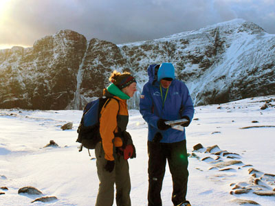
It has to be the Cairngorm plateau in winter. I get lost, or at least cartographically challenged, on a regular basis when orienteering or generally exploring. But the potential winter hazards and operating in poor weather conditions on the plateau mean the consequences can be very serious.
I have been involved with some massive navigational errors, once ending up the wrong side of a 7,500m peak we were aiming to climb in the Himalayas, and going down completely the wrong valley in Greenland, which took us several days out of our way. There are back stories to those but essentially, we were exploring, not in any danger, and there was no real time pressure on us to be back anywhere
What's the best part about being a HARVEY Maps Ambassador?
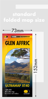
Like many people, I love studying and using maps, so to be associated with HARVEY Maps is a bit of a dream come true. The company produces, undoubtedly, the finest maps for recreation in the world, down to the skill and passion of mainly Robin, Sue and Peter at the start of the company. They developed today's mapping from their world class orienteering maps and mountain marathon maps using the 1:40,000 "magic scale".
The innovation of the map sheets is also impressive, with trail maps all on one sheet, the BMC mountain series placing the mountain range in the centre of the map and using the back for information, and all on waterproof paper. Daring to print the Pentland Hills map where the grid lines are angled diagonally across the sheet so the whole area can be shown on one side is also to be admired! It is a small employee owned company of enthusiasts, great to work with and I get to write about my passion for navigation, and how we might teach and learn it.
This is difficult because I think I've been incredibly fortunate to have survived a career in the outdoors with a supportive family despite all my expedition absences. I've completed 26 winter seasons in Norway and Scotland responsible for managing mountaineering and skiing programmes, with large numbers of students and staff in a remote and hostile environment… this was a personal record and required a level of resilience.
In expedition terms, probably crossing Greenland, following in Nansen's footsteps beats a couple of Himalayan summits. This route is rarely done due to sea ice issues but we walked out of the sea on the east coast and into it on the west coast 27 days later. Climbing in the Himalayas you can look down and see the other camps below, and descend to base camp, even from 8000m, in a day or two on fixed ropes. In the middle of Greenland it is two weeks in either direction, with no established camps to bail out to and no route to follow around the crevasses etc. All that is between you and the elements is a couple of sheets of thin nylon and the ability to melt ice.
Where or what is something you have yet to do on your bucket list?
Well, the bucket list is diminishing with age and knees, so, as a pragmatist, I don't feel too driven and I am mindful of the impact of travel these days. However, I would like to finish off the Munros. I spent some time as the base commander on South Georgia shortly after the Falkland war before British Antarctic Survey were allowed back, but I never properly made it to Antarctica. I've also always wanted to get to Concordia below K2 to see the rest of the 8000m peaks.
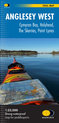
What's your favourite HARVEY map and why?
The Ben Nevis and Glencoe Superwalkers. I spent 3 great years there, at Ballachulish, and there is always so much to explore on those maps, and there is a great history to go with it.
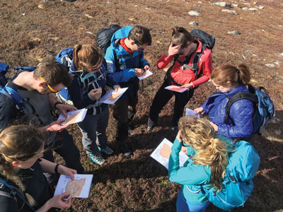
What would you say is the most important piece of navigation advice you could give?
Navigation is about decision making and confidence. You can't be confident about something you don't practice; go orienteering!
No matter what kind of expedition you're going on, what's one piece of kit you never leave behind?
My reading glasses - how sad is that? But I struggle to read the map without them these days. More seriously though, I am partial to a good cup of tea, but not one made hours earlier that comes out of a thermos flask, so I always have my MSR gas cooker, a mug and brew kit. There is something quite satisfying about making a brew and with an efficient cooker; it takes only a couple of minutes and the world is a better place.
Return to the Navigation Blog