01786 841202
 FREE UK tracked delivery
 Order by 12pm Mon-Fri for same day dispatch


Navigating the Great Glen Way by canoe
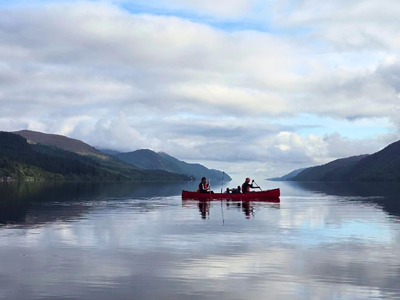
The Great Glen Way is best known as a walking and cycling trail, but the Great Glen Canoe Trail (Great Glen Canoe Trail Guide: Route, Camping & Tips) follows the same line, and HARVEY's Great Glen Way map (XT40) (Great Glen Way Map) covers it by boot, bike or boat. I used it for the whole trip, from planning at home to deciding where to camp each night, and it turned out to be one of the most useful things in my canoe kit (Multi-Day Canoe Kit List For the Great Glen Canoe Trail).
This is how we used it: planning each day, working around the locks, and rethinking everything when a gale warning hit Loch Ness.
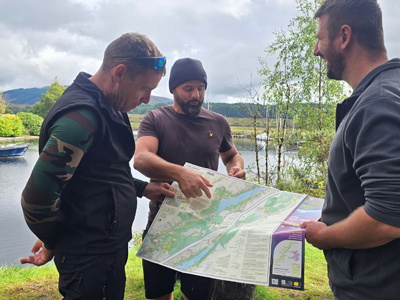
The Great Glen Way map splits the route into four sections. By coincidence, that matched almost exactly how our schedule ended up: one section a day.
Most of the planning came down to the locks. Paddlers aren't allowed through them, so every lock or flight of locks means a portage. You unload the canoe, wheel it round on a trolley and load it back up again. With six of us and three canoes full of kit, each one cost us time.
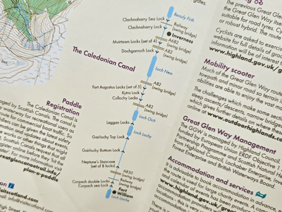
We launched at the top of Neptune's Staircase in Banavie, which saved us carrying around its eight locks. There are still plenty more along the rest of the route, and seeing them laid out in order on the map made it much easier to plan realistic days. We could see where the schedule had slack and where it didn't, which a written itinerary never shows you.
The grid squares helped too. A glance told us roughly how far a section ran and how long it would take, without any sums on the water.
How the map held up on the water
HARVEY make it as a tough, all-weather map, and four days in the bottom of a canoe is a hard test for any map. Ours was folded, refolded, rained on and handled with wet hands every day. It didn't go soft at the creases, tear at the folds or run, and by the end of the trip it still looked as good as new.
There's more on it than just the route line. The Trailblazer Rest sites, the basic campsites built for paddlers and walkers, are all marked, along with places to pick up food, water and cash. That's handy to know at a glance when supplies are running low.
The legend is easy to read on the move, and there are links to further information on specific sections of the trail and the surrounding area.
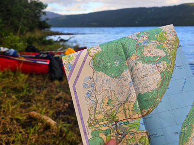
Every morning started the same way: coffee and the map out, working out what the day ahead looked like before we set off. Then we paddled in blocks, with breaks for coffee and lunch, before pushing on to find somewhere to camp.
We only used one of the Trailblazer Rests, on Loch Lochy on our first night. After that, we wild camped wherever suited us once we'd had enough for the day: in woodland just past Fort Augustus, then on a beach across Loch Ness from Urquhart Castle. Having the rest sites marked on the map meant we always had a fallback if we didn't find anywhere better.
One thing to know if you're paddling the Great Glen: the Loch Lochy Trailblazer Rest at Glas-dhoire has moved. A large construction project on the original site means the camp now sits about a kilometre back down the loch, so you'll reach it sooner than the map suggests. Look for a beach with a carved wooden canoe with three bears sitting in it.
Replanning Loch Ness around a gale
The map was most useful when we had to change the plan.
We reached Fort Augustus at the end of day two and planned to take Loch Ness and the run into Inverness over the next three days. Then the forecast showed gale-force 8 winds for what would have been our final day. Loch Ness is about 36km (22.5 miles) long and completely exposed to the wind running down the glen, so it's no place to be in a gale.
With the map out, we could see exactly how much of the loch we had left and how far we'd need to push each day to finish early, which made the decision much easier.
We stopped at Foyers for lunch rather than camping there, and pushed on to a beach across the loch from Urquhart Castle. The next day, we paddled the rest of Loch Ness and all the way into Inverness, ahead of the worst of the weather. It meant two very long days, including almost eight hours into a headwind, but we finished a day early, and Donald from Explore Highlands met us in Inverness to collect the canoes.
- Don't rely on your phone: signal is patchy along the lochs, so carry a paper map you can trust.
- Portage on the left: take out on the left-hand side at every lock, apart from the final portage in Inverness, which is on the right.
- Cross the ends of the lochs diagonally: hugging the shore and then cutting straight across puts the waves side-on. A diagonal line keeps them behind you.
- Pick the right shore: stay on the north shore of Loch Lochy, then the south shore of Loch Oich and Loch Ness. On Loch Ness, the north shore runs alongside the A82 and has fewer places to land.
- Check the forecast every morning: then look at the map and decide how far you can go before the wind picks up.
Final thoughts
Whether you're walking, cycling or paddling the Great Glen Way, a map you can trust for the whole route makes a big difference. Mine survived four days of Highland weather, weighed next to nothing compared with a standard OS map, and had everything I needed on one sheet. However, you tackle the Great Glen, pack a paper map you can rely on, not just an app on your phone.
Author bio
Steve Cleverdon is an outdoor writer and paddleboarder based in East Sussex, sharing gear reviews and adventures from the trail and water at stevecleverdon.com.
If you would like to try navigating the Great Glen Way by canoe then take a look at our , and you too can enjoy the wonderful scenery on offer in a different way.
Return to the News & Features Blog