01786 841202
 FREE UK tracked delivery
 Order by 12pm Mon-Fri for same day dispatch


Reading the Tide
with Richard Taylor
Tell us about yourself, and how you got into kayaking / sea kayaking?
I've been kayaking for over 30 years now. My dad got me into it when I was a kid. At first, I'm not sure I actually liked kayaking that much, but I did like spending time with him, so I kept going along to swimming pools, learning to roll, and then slowly getting out on rivers. As I got older, it became a massive part of my life. We used to go up to Scotland in the summers and paddle whitewater rivers, but also sea kayak around the islands, the Inner Hebrides and the Summer Isles. That really stayed with me and has been a big part of my kayaking journey.
Kayaking then shaped quite a lot of my career. I worked as an outdoor instructor in Scotland, then later spent seasons in Jackson Hole in America guiding kayak trips, including whitewater, lake and overnight trips in places like Yellowstone and the Tetons. I was lucky enough to paddle some incredible places in America, including the Middle Fork of the Salmon and the Colorado River through the Grand Canyon, which is still probably the best kayaking expedition I've ever done. Over the years I have also had the opportunity to go on many different kayak expeditions both white water and sea kayaking and have paddled 6 of the 7 continents, I'm still hoping to paddle in Antarctica one day!
I studied industrial design at Brunel, and that eventually led me into designing kayaks professionally. I worked at Pyranha and P&H Sea Kayaks for about six years and was involved in the design of around 25 kayaks and canoes, including sea kayaks like the Cetus and the Delphin. More recently I now run a product design agency www.mouse.design and we have enjoyed designing lots of outdoor sport products over the years.
So, I suppose the map brings together a lot of things that have been running through my life for years: kayaking, reading water, design, product development and trying to make useful things for people to enjoy on the water.
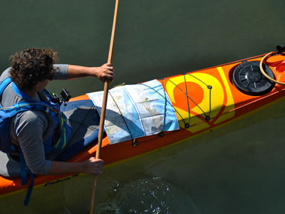
The simple answer is that the tide can often be more powerful than you are. When you're in a sea kayak, paddleboard or any human-powered craft, you don't have much speed compared with the tide. Around Anglesey, the tide can easily outpower you, so you have to work with it rather than fight it. There are already great resources out there, tide tables, charts, almanacs, tidal atlases and guidebook and plenty of apps, but you often need to pull several things together to build a clear picture. The idea behind the tidal map is to give people a practical, on-the-water planning tool. Something you can take with you and use to make better decisions.
It doesn't replace proper planning. You still need to check the weather, swell, tide times and think about the ability of your group. But once you know, for example, high water at Holyhead, the map gives you a way to interpret quickly and, on the fly, what the water is likely to be doing around the coast.
It shows flood and ebb flows, tidal races, overfalls, tidal gates, access points, landing places and shallow areas where the seabed can really affect the sea state. It's a way of turning quite complex moving water into something visual and practical.
What are the common misconceptions people have about tides?
I think the biggest misconception is that tides just "come in and go out". That is true if you're standing on a beach watching the water rise and fall. But that's only the visible part of a much bigger system. In reality, tides flow. They move like a river, roughly one way for six hours and then the other way for six hours.
For sea kayakers, that matters because the coastline, cliffs, headlands, bays and seabed all affect how that flow behaves. Around Anglesey, that becomes really important because the island sits right on the north-west corner of Wales. You get big tidal movement coming North up the Welsh coast, swinging round East towards Liverpool, and Anglesey becomes a sort of pivot point for that water. This pivot point impacts the tidal flow, on the apex of the corner like Carmel Head it increases the speed of flow and creates lots of hydrodynamic features as the tide interacts with the coastline and the underwater topography.
That is why Anglesey is such a dynamic place. It can be challenging to navigate, but it is also what makes sea kayaking so much fun. The tide creates races, eddies, overfalls and river-like features in the sea. If you understand them, they can become something you use and enjoy rather than something you're caught out by.
Who do you think this map will appeal to?
First and foremost, sea kayakers. That was the original thinking behind it, the idea came out of my training as an advanced sea kayak leader. It aims to bring together all the critical on water information that will enable you to make good decisions while operating in a dynamic environment.
But I think it will appeal more widely than just kayaking. Paddleboarders, coasteerers, kayak anglers, wild swimmers, dingy sailors, small craft users and anyone who is interacting with the sea without a big boat and powerful engine will find value in understanding what the tide is doing.
It may also appeal to people who are simply interested in the coast, walkers, wildlife watchers, local users, or people who want to understand why certain places behave the way they do. Really, it's for anyone who looks at the sea and wants to understand it a bit better.
Where next- what's the next coastline?
This first map is North West Anglesey, but it has always been the first map in a wider tidal map series.
The concept from the start was to create a specialist mapping series for sea kayakers, and small craft users, to create a practical tidal map series that help people interpret moving water close in to the coast. The immediate plan is to complete Anglesey as a full set. Anglesey is the right place to start because it is one of the UK's classic sea kayaking destinations and one of the most dynamic tidal environments we have. It's important to complete the set of maps for the island as the first step.
After Anglesey, we have already identified the next priority coastlines for the series. These include other parts of North Wales, Pembrokeshire and South Wales, sections of Devon and Cornwall, the north-east coast around the Farne Islands, and key areas of Scotland, especially the Inner Hebrides.
The series will focus on coastlines where tidal flow genuinely shapes the journey: headlands, islands, races, overfalls, tidal gates, crossings and areas where the interaction between tide, seabed and coastline really matters. So, this is map one, but the bigger ambition is very clear: to build a trusted UK tidal map series for the key moving-water coastlines that paddlers and small craft users return to again and again.
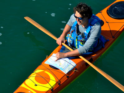
There are the basics first: kayak, paddle, buoyancy aid, helmet where appropriate, and spray deck. Without those, you're not really getting on the water.
But in terms of the key things, I personally want with me, I'd say:
- A charged VHF radio, because communication can be really important at sea.
- A personal locator beacon, which is your real last line of defence. I hope I never need to use it, but I always want it there.
- A compass, because fog and mist can come in quickly, especially around Anglesey, and there are times when a bearing is the only thing you've got.
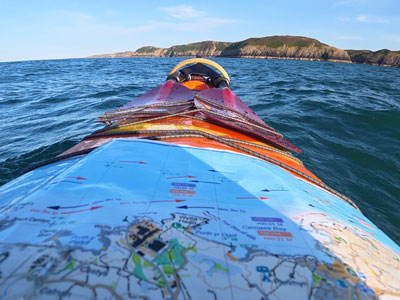
- And now, of course, the tidal map. That will definitely be coming with me.
Most importantly, what does a sea kayaker take for lunch?
For me, it's hard to beat a tin of mackerel in tomato sauce and a wrap. Add a flask of tea and a few bars, and that normally sorts me out for the day. Sometimes I'll take a stove and cook something properly, but more often than not it's mackerel, wraps and tea. It's not glamorous, but it works.
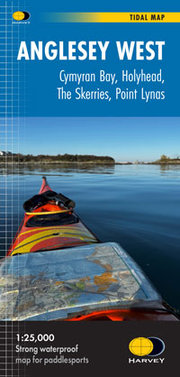
You can be the first to get your hands on our latest map innovation, the Anglesey North West Tidal Map, and find out for yourself how Richard's ideas have been brought to life.
Return to the News & Features Blog