FREE UK tracked delivery
 Order by 12pm Mon-Fri for same day dispatch
May 2021 - Beginner's Guide to Navigation - Simple Strategies
by Nigel Williams
Catching features. We looked at "ticking" off features we see along our route and on the map. An extension of that is recognising a "catching feature". Identify a really obvious feature that crosses our path, or to the side of it within a couple of hundred metres beyond a view point or a small path junction that we need to find. Those might be easy to miss if we were in deep conversation for instance.
An example of a catching feature might be a bridge over a stream or the edge of a wood. They act as an alarm bell that we have overshot what we were looking for.
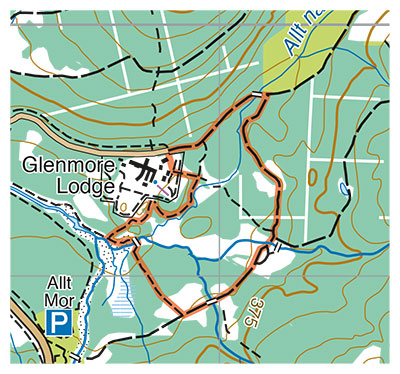
Distance judgement. This is part of appreciating the map scale and being able to measure distance on the map and relate it to the ground. A quick appreciation can be done by judging a distance against a grid square. Directly across a square is 1km, so half is 500m and a quarter is 250m. Detailed measurements can be worked out depending on the map scale, how many millimetres on the map represent 100m on the ground. Scales on the compass help with this.
Pacing. A useful life skill is to be able to pace 100m. At a running track or full sized sports pitch generally found around most towns and villages, pace the length of the pitch, usually 100m, walking completely naturally and counting only each time one (ie just the right foot) strikes the ground. The average person takes around 65 paces to walk 100m on the flat but over 6ft tall may be nearer 60 and if nearer 5ft tall then around 70. Add around 5 paces if it is gently up hill and take off around 5 paces if downhill. Pacing is generally 90 -95% accurate over short distances, even for a novice, but of course it is dependent on an accurate measurement down to the half millimetre on the map.
Sometimes finding our way out of the car park and finding the first junction at the start of a walk can be one of the most tricky bits of navigation. For example, there may be 2 junctions reasonably close together. The one you want is 250m away. Just count 65 twice and then 33, give or take 5 paces or so you should be at the junction you need. Don't worry too much if the distance seems to measure around 270m. Do 250 and a bit more, remember you are actually looking for a mapped feature on the ground.
Pacing is rather antisocial. Timing can be shared with others keeping an eye on the clock as well.
Pacing and timing are in effect mental catching features and can be used to set a limit to how long or far you expect to travel to find a location.
Return to the Navigation Blog