FREE UK tracked delivery
 Order by 12pm Mon-Fri for same day dispatch
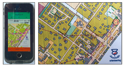
September 2020 - MapRun
by Nigel Williams
Over 30 countries are using it. Orienteering clubs across the UK are mapping and putting courses online on a weekly basis. There are over 130 across Scotland. Check your local orienteering club website. See www.scottish-orienteering.org for more information and to download the maps.
When it comes to navigation generally there seems to be either a paper or GPS mentality. We hear of an increase in mountain rescues where the only navigation tool has been the phone. Of course those same people may have needed help if they had relied solely on a paper map and compass, but possibly they would not have gone out in the first place if they had no skills or confidence with map and compass. Map Run offers the option of learning to use both together which is how most outdoor professionals now operate, partly because it allows them more head space for interaction and managing safety of clients knowing the GPS as a backup, will pin point them in seconds.
In the last blog I briefly talked about the need to develop the brain's navigation processes and that navigation requires decision making and confidence. It also requires observation skills.
Most people will have used Satnav in the car to find their way to an unfamiliar place and then felt unable to retrace the route without Satnav. This is because the brain has not been able to create a mental map from observing and recording multiple land marks and the sequence of direction changes etc. Driving safely is also a distraction and an indication that navigation tends to need our full attention.
Experiments have been done with people on foot following GPS mapping and tracking on an unfamiliar back street urban route. Unexpectedly at the end they have the GPS and mapping disabled and have to retrace their steps from memory. Same thing is done with other individuals who used a paper map. They proved to be more successful in retracing their route because they had to constantly relate the map and ground, observing landmarks and their relationship to each other, which built up a mental map.
This demonstrates that total reliance on the GPS is less effective at activating and developing the neurological navigation processes. Secondly, that online learning to navigate (which has been talked about in the outdoor sector quite a bit during the lockdown) has only limited use and that we need to engage with the outdoor environment and terrain in order to develop the neurological navigation processes and confidence.
Return to the Navigation Blog