FREE UK tracked delivery
 Order by 12pm Mon-Fri for same day dispatch
Why should I pay for a map?
by Holly, HARVEY Maps Cartographer
These questions are all perfectly understandable, if a little frustrating. Virtually everyone has a smartphone, and every smartphone comes with a maps app. The entire world in the palm of your hand (or so it would seem!).
There's no question that companies like Google and Apple have revolutionised the way we navigate, particularly in urban areas. I live in Glasgow and use the Maps app on my phone all the time. I use it to find addresses, new restaurants, to send my live location when meeting up with friends, and for live traffic and public transport information. It's a fantastic tool. But as anyone who lives anywhere even remotely rural will tell you, the further you stray from the cities the less useful they become.
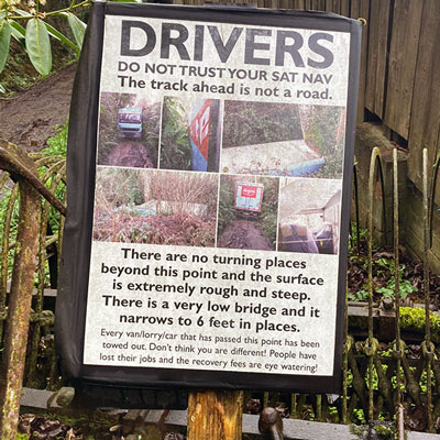
Companies like Google and Apple (and indeed anyone that provides whole-world coverage) undoubtedly rely on some degree of automation to collect their data, which is how mistakes like this occur. In cities and other highly-populated areas, errors are reported and corrected fairly quickly (often from user feedback), but rural areas are updated much less frequently and things can get missed.
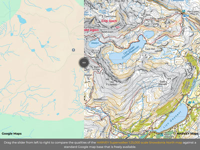
Then there's the issue of detail. Zoom in to any city on your phone maps app and compare it with an area of countryside. Chances are it will look like there's nothing there. Check out our useful Map Comparison Slider to see the difference between the mapping of Snowdon (Yr Wyddfa) on Google Maps vs the HARVEY Snowdonia North Superwalker 1:25,000 scale map.
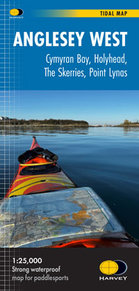
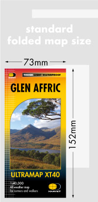
In order to plan your adventures and make the right decisions when you're out in the wild you need to have all the necessary information in front of you, and know it can be trusted. This is what HARVEY Maps aims to provide in all of our products: reassurance. Producing maps with this level of detail takes time and skill - it can't be rushed or automated. Our expert photogrammetrists plot details like contours and crags by hand, our experienced survey team walk the trails and mountains on foot, and we regularly reach out to the people that know the area best (National Park rangers, mountain rescue teams, trail officers, and so on) for any comments and corrections they may have. This is why good hiking maps aren't free.
We'd love to be able to create our maps more quickly and for less money. We keep a constant eye on new technologies that have the potential to make our production processes more efficient, but the truth is (at least for the moment) there aren't any satisfactory shortcuts, and the team is not prepared to sacrifice the quality of our data - the detail is too important.
Recent years have seen record numbers of mountain rescue call-outs driven by people that aren't adequately prepared. The sharpest rise has been for 18-24 year-olds, and poor-quality navigation apps (as well as social media and influencers) has been cited as a contributing factor.
The responsibility doesn't just lie with the end users: this is an age group that have grown-up with digital maps at their fingertips 24/7. Mapping providers, apps, and influencers all have a responsibility too. That's why we choose our partners carefully: HARVEY maps are available on several excellent digital mapping apps (ones we use ourselves on our survey trips), and we work closely with our ambassadors to promote safe and responsible outdoor adventures on social media.
It's on all of us to make sure people are safe in the outdoors. That's why we will keep answering these questions, for as long as people keep asking them.
Click for more information on our digital mapping partners.
Return to the News & Features Blog