FREE UK tracked delivery
 Order by 12pm Mon-Fri for same day dispatch
Going Solo
by Nigel Williams
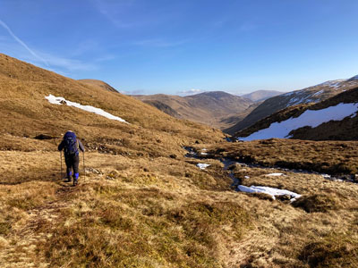
As with most outdoor activities and adventures, progression is the key to developing confidence and skill. Start with familiar terrain and build up to more remote and unfamiliar areas. Begin in good weather and learn to cope with poorer weather and, eventually, winter conditions. Progress from being part of a team to leading a team, building the decision-making skills required for a solo trip.
Developing planning and navigation skills will have the biggest impact on a solo adventure and can make the difference between enjoying a successful trip and having to call for help from Mountain Rescue.
Stage 1 - Play
Where there is little emotion; mild, calm enjoyment through relatively easy participation; well within a person's skill level; success is a certainty. This might be a regular local walk, for instance.
Stage 2 - Adventure
Where there is a level of enjoyment and excitement; the outcome is certain to be successful, but we will be required to use our capabilities more fully and will maintain control over the situation and ourselves. Our first Munro, in pleasant conditions, perhaps?
Stage 3 - Frontier Adventure
All one's skills will be required and the outcome is uncertain. It is a peak emotional experience, where the challenge is very close to our limits. Maybe our first solo walk in unknown terrain or our first long ridge walk or first Munro with recently acquired crampons, ice axe, avalanche awareness and winter navigation skills.
Stage 4 - Misadventure
Characterised by a person choosing, or being forced to participate in, challenges beyond their capabilities, resulting in negative emotions (fear, hurt etc.), possible injury and perhaps even death.
This model provides a different insight into the concept of progression and getting the balance right between risk and adventure.
There are some basic pieces of good practice for going solo:
- Thoroughly check the weather and its likely impact on your journey.
- Study the map and get a feel for the terrain.
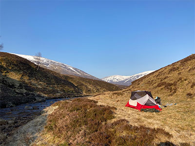
- Leave your route details, expected return time etc. with someone who will look out for you. These days it would be wise to have a phone with digital mapping, along with a power bank for recharging. Apps like OS Locate can share your position as a text. Some people carry 'spot' tracking devices, which can be used as a location beacon, sending your location direct to the emergency services via satellite.
Success comes down to judgement and decision making, which are based on having an appropriate level of experience (either from informal or formal training) and the right equipment, and the knowledge of how to use that equipment correctly.
Don't be put off though - a solo adventure is the most rewarding and empowering experience because there tends to be a greater engagement with nature, and it always feels like a Frontier Adventure.
Be prepared!
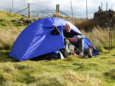
Make sure you carry the right kit when going solo - Nigel discusses his summer walking kit list in a previous blog.
A good map is key - HARVEY British Mountain Maps are produced at 1:40,000 scale and are ideal for hill walkers who want a detailed map of technical terrain that shows more features for safe, accurate navigation. As they are waterproof, they can also double up as something to sit on if the ground is wet!
Return to the Navigation Blog